
Mission Peak Hike
Location : Mission Peak Hike, Bay Area
Total distance : 6.8 miles round-trip (out and back)
Elevation gain : 2,100 ft
Peak elevation : 2,500 ft
Tree Cover : No tree cover. Sunscreen highly recommended.
Parking : Parking lot near the trailhead.
Trailhead : Click here
Satellite map :
Click on the image for an interactive map
Terrain map :
Click on the image for an interactive map
Mission peak is one of the most popular hiking destinations in bay area, California. There is a paid parking lot close to the trailhead which is very convenient. Hike starts at this trailhead as shown in the picture.


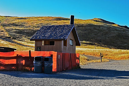
You will pass through a couple of gates. Look for this open gate, you'll have to make a U-turn to the right to continue on to Bay Area Ridge Trail. There are several forks on this hike and it's easy to get confused. But if you start your hike at Ohlone college like we did then there is an easy way to remember the directions. Keep right at all the forks except one. The only fork where you keep left is immediately after the restrooms.
This 6.8 mile roundtrip hike with about 2100ft of elevation gain will be steep towards the end. Follow the directions in the images and refer to the interactive map while planning the hike.


Today's fun fact is about the monunent with siting tubes at the peak. If you are thinking of hiking Mission Peak then there is a very good chance you know the peak with its monument and the surrounding panaromic views is a great selfie-spot. But did you know whats hidden below it? In 1990s a sculptor and a park ranger named Leonard Page created this monument and buried a bottle of zinfadel and a time capsule under it. This is due to be opened in 2090, 100 years since then. From the top you can see the peaks around bay area and the Calaveras reservoir.
As for today's fitness tip, if you are someone who experiences leg cramps during or after a hike then stretching your legs before starting your hike might help you.


Keep left at the restrooms. The trail gets steeper from here onwards. There is no shade from any trees after this whatsoever so it's a good idea to use sunscreen. And do carry enough water. If you do not know how much is enough, carry more than you think you need.
Gallery
Recommended for you. Click on the images below.
Mt.Islip Hike
Mt.Waterman Hike


